- Screen Colours:
- Normal
- Black & Yellow
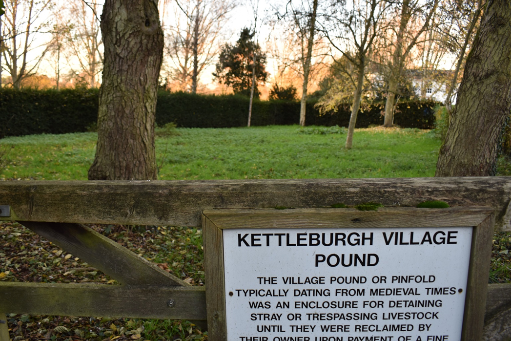
This page tells you about the village Pound
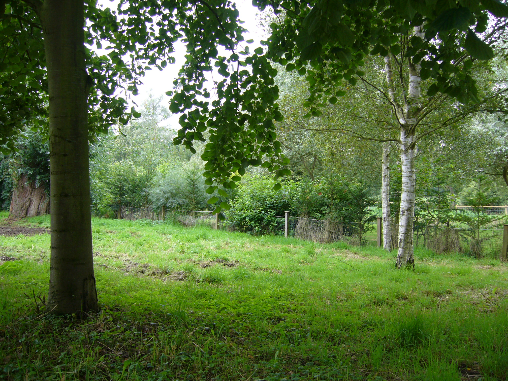
The Pound is of ancient origin, but is now a tranquil tree filled area close to the river Deben. It originally abutted the river before the river's course was changed.
You can reach the Pound from Mill Lane and from the footpath which leads away from the pub garden at the bottom of the Chequers car park.
It is owned and managed by the Parish Council following a Commons Registration Authority decision.
The area is currently managed as needed, but there is a draft Management Plan for consideration in due course. You can find all available detail about the Pound in the Plan.
Cultural Heritage and Archaeology/past land use
The Pound probably dates to mediaeval times. A pinfold/pound is defined as an enclosure – Saxon ‘pundfald’ and ‘pund’. The map of commons shows it as Common Land, without a plot number, labelled ‘Pinfold’, the south-eastern quarter without wall or fence (shown by a dashed as opposed to solid line). A circle is marked within, and there is a clear statement in the ownership registration document “…parts of the Pound were still standing…”. The circle therefore probably represented a walled pinfold, set in a small area of waste ground of the manor. The walls were most likely of brick, mudstone, or a combination. It was originally by the river so that the responsible Pinder could water the temporary animal residents.
The land may or may not have contained trees over time. Boundaries wise, it isn’t a historic common in the usual sense. It would not have needed firm boundaries if it contained a built pinfold, but may have also been used for grazing, maybe geese, or storage, as it was in the 1940s. The Pound land is said to have been gifted by the Parish of Dennington. There was a time of some confusion. This was caused by the moving of the course of the river Deben and filling in of its original course and associated waterways of the former mill, probably in the 1950s. Correspondence refers to ‘the mill stream’. c19th maps show the main river being controlled, presumably for mill purposes, with a substantial branch passing under the mill. The western boundary of the Pound abuts the former course of the river/mill stream, not the current course.
Location and Site Boundaries
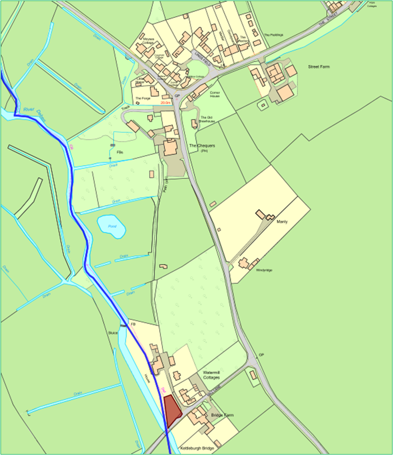
The Site Map shows the site in its setting. The land is in Kettleburgh, a parish in East Suffolk (Parish Boundary marked blue). It totals just over 1/6th of an acre/700 m2 and lies on Mill Lane, which crosses the River Deben at Kettleburgh Bridge; it is bounded on the southeast by Mill Lane, on the northeast by the access track that leads past Watermill Cottages to Watermill House (on the site of the old corn mill). The river was, before it was straightened, the western boundary. The other relevant local authorities are East Suffolk at District Level and Suffolk at County level.
The land is a small broadly triangular area of common land, consisting now of rough grass with several mature trees. It is hedged and fenced with one large and one small access gate. The exact area on the ground has been reviewed several times, always with the same conclusions, so there is no doubt about where and what the area of land called the Pound is.
It sits within a wide area of Enclosed Commons of gently rolling lowland landform. Land use is pastoral with mainly arable farming. It is an open landscape with views through hedgerow trees and strips of linear tree cover along watercourses.
he site is shown on Ordnance Survey maps, grid ref. TM 263 597. Its address is Mill Lane, Kettleburgh, IP13 7JS.
Dark night skies are recognised as a key part of the area’s tranquillity and have been mapped by the Campaign for the Protection of Rural England (CPRE).
Tenure
This page has no legal standing. Refer to original documents before taking any decision or action that may have legal implications.
The land known as The Pound, Kettleburgh, East Suffolk is the land comprised in the Land Section of Register Unit No. CL 145 in the Register of Common Land maintained by Suffolk County Council. Ownership by KPC as freehold under s.4 of the Commons Registration Act 1965 was confirmed in 1979.
(The ambiguous term ‘common’ refers to the rights held in common by certain people to use the product of the soil. Commons are a remnant of the manorial system which, from mediaeval times, has been the basis of the country’s economy [Clayden, 2007]. Owners of certain properties and/or parcels of land are entitled to exercise rights of common on certain areas of common land as detailed in the County commons registers (held and maintained by county councils). Most common land is privately owned. Owners of commons enjoy largely the same rights as other landowners, except that common land is subject to ‘rights of common’ held by other individuals (commoners) over the common, and to the special statutory controls that may apply under commons legislation.)
There are no known easements, Manorial Rights, Covenants, or Commoners with Rights of Common in respect of the Pound. Without commoners’ rights such activities can be undertaken by members of the public only at the discretion and authorisation of KPC.
Some points remain to be investigated, including the original rights to charge for pounding and release of livestock, and wayleaves for utility companies to install and maintain their infrastructure.
A Public Right of Way (footpath only, Kettleburgh No. 26) runs N – S to the E of the land beyond the hedge. KPC has no rights or obligations regarding this path, other than its normal rights and obligations regarding footpaths in the parish.
Status of the land
The Pound land is probably not covered by any legal designation other than being a Common, but this needs to be verified, including the statuses of nitrate vulnerable zone and groundwater source protection zone. A further issue might be whether the built Pound should be any sort of monument.
The legal basis for the hedging and fencing is unclear but there is often a presumption that neighbouring properties may fence against common land. The trees were planted by previous managers with the aim of providing amenity value.